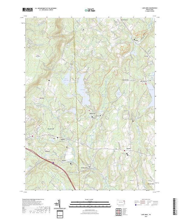
2023 Map of Lake Ariel
USGS Topo · Published 2023About this map
Lake Ariel and its surrounding glacial terrain define this section of the Poconos, where the West Branch Wallenpaupack Creek and Middle Creek drain the eastern slopes of the Moosic Mountains. This modern data shows a landscape deeply rooted in its 19th-century settlement patterns, anchored by crossroads like Hollisterville, Hamlin, and Maplewood. Small, family-named burial grounds like Simon Cem and Shaffer Cem appear alongside larger community sites such as All Saints Cem, offering precise locations for genealogical research. The complex hydrology of the region is evident in the many wetlands and smaller bodies of water, including Kizer Pond, Beyea Pond, and Meigs Pond, which sit between the prominent peaks of Mount Cobb and the surrounding woodlands. This detailed documentation of modern Wayne County topography preserves the legacy of early turnpike routes and localized farming communities that have evolved into contemporary residential and recreational spaces.
Find a feature on this map
141 named features on this map. Tap any name to fly to it.
Don’t see what you’re looking for? This feature index may not catch every label — zoom into the map to look around manually.
Map Details
Editions of this 2023 Lake Ariel Map
This is the sole edition of this map. No revisions or reprints were ever made.
Other maps of this area

1889 · Scranton
USGS Topo · 1:62,500

1891 · Scranton
USGS Topo · 1:62,500

1892 · Honesdale
USGS Topo · 1:62,500

1892 · Dundaff
USGS Topo · 1:62,500

1893 · Scranton
USGS Topo · 1:62,500

1928 · Ariel
USGS Topo · 1:62,500

1932 · Ariel
USGS Topo · 1:62,500

1943 · Scranton
USGS Topo · 1:125,000

1943 · Honesdale
USGS Topo · 1:125,000

1946 · Olyphant
USGS Topo · 1:24,000