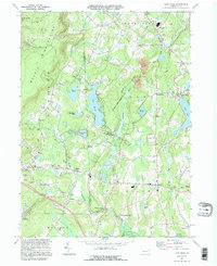
1994 Map of Lake Ariel
USGS Topo · Published 1995About this map
The Moosic Mountains dominate the western edge of this terrain, giving way to a dense network of water bodies and small rural crossroads. Significant water features such as Lake Henry, Lake Ariel, and the sprawling Tisdale Swamp define the local geography, while the West Branch Wallenpaupack Creek drains the central valley. The landscape is marked by a history of resource extraction and local industry, evidenced by numerous Gravel Pits and the presence of Wallenpaupack Mills.
Find a feature on this map
54 named features on this map. Tap any name to fly to it.
Don’t see what you’re looking for? This feature index may not catch every label — zoom into the map to look around manually.
Map Details
Editions of this 1994 Lake Ariel Map
This is the sole edition of this map. No revisions or reprints were ever made.
Other maps of this area

1889 · Scranton
USGS Topo · 1:62,500

1891 · Scranton
USGS Topo · 1:62,500

1892 · Honesdale
USGS Topo · 1:62,500

1892 · Dundaff
USGS Topo · 1:62,500

1893 · Scranton
USGS Topo · 1:62,500

1928 · Ariel
USGS Topo · 1:62,500

1932 · Ariel
USGS Topo · 1:62,500

1943 · Scranton
USGS Topo · 1:125,000

1943 · Honesdale
USGS Topo · 1:125,000

1946 · Olyphant
USGS Topo · 1:24,000
Featured Places
- South Canaan Township, PA
- Sterling Township, PA
- Lake Township, PA
- Red Oak, Jefferson Township
- Saco, Jefferson Township