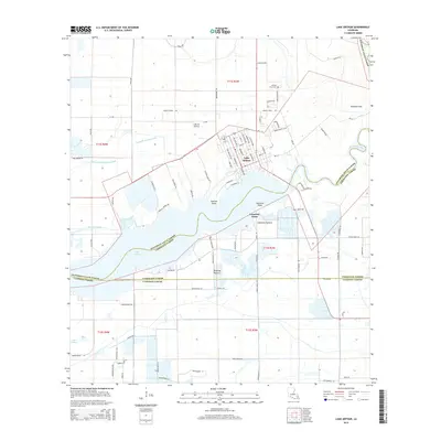
2015 Map of Lake Arthur
USGS Topo · Published 2015About this map
Lake Arthur serves as the focal point of this southwestern Louisiana landscape, where the waters meet the winding Mermentau River and Mitchell Bayou. The town of Lake Arthur is laid out in a clear grid along the northern shore, featuring streets like Grand Ave and State St that lead toward the waterfront. This 2015 U.S. Geological Survey representation highlights the complex parish boundaries of the region, where Jefferson Davis Parish, Vermilion Parish, and Cameron Parish converge amidst a network of drainage canals and pastures. To the northeast, Andress Cove and the Andress Cove Cem mark local family-named landmarks. The terrain is defined by named points and coastal grazing lands, such as Gaithes Point, Laurents Point, and Rivillons Pasture, illustrating the deep connection between the local economy and the marshy geography of the Mermentau basin.
Find a feature on this map
96 named features on this map. Tap any name to fly to it.
Don’t see what you’re looking for? This feature index may not catch every label — zoom into the map to look around manually.
Map Details
Editions of this 2015 Lake Arthur Map
This is the sole edition of this map. No revisions or reprints were ever made.
Other maps of this area

1934 · Latania Lake
USGS Topo · 1:24,000

1935 · Latania Lake
USGS Topo · 1:31,680

1946 · Lake Arthur
USGS Topo · 1:31,680

1946 · Mermentau
USGS Topo · 1:31,680

1946 · Jennings
USGS Topo · 1:31,680

1947 · Thornwell
USGS Topo · 1:31,680

1947 · Welsh
USGS Topo · 1:31,680

1949 · Gueydan
USGS Topo · 1:31,680

1952 · Lake Charles
USGS Topo · 1:250,000

1954 · Grand Lake East NW
USGS Topo · 1:31,680