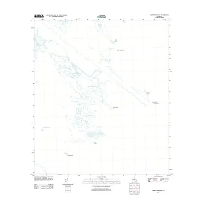
2012 Map of Lake Athanasio
USGS Topo · Published 2012About this map
Saint Helena Bay and the surrounding marshlands of Saint Bernard Parish define this coastal landscape, where land and water merge into an intricate network of inlets and islands. The 2012 survey illustrates the complex geography of the Mississippi River Delta's outer reaches, featuring tidal passages like Mulatto Bayou and the winding Bayou Frenepiquant. Human engineering appears in the form of Canal Pecal, cutting through the wetlands to facilitate movement between larger bodies of water like Lake Machias and Seven Dollar Bay. The map captures numerous landforms subject to the constant influence of the Gulf, from Coon Nest Island to the southern tip at Point Fortuna. This detailed record is essential for understanding the shoreline configuration and maritime landmarks such as the Lake Eloi Light 1 during the early 21st century.
Find a feature on this map
17 named features on this map. Tap any name to fly to it.
Don’t see what you’re looking for? This feature index may not catch every label — zoom into the map to look around manually.
Map Details
Editions of this 2012 Lake Athanasio Map
This is the sole edition of this map. No revisions or reprints were ever made.
Other maps of this area

1893 · La Fortuna
USGS Topo · 1:62,500

1893 · Shell Beach
USGS Topo · 1:62,500

1893 · Dime
USGS Topo · 1:62,500

1895 · Bodreau
USGS Topo · 1:62,500

1935 · Morgan Harbor
USGS Topo · 1:31,680

1935 · Lake Athanasio
USGS Topo · 1:31,680

1935 · Lake Calebasse
USGS Topo · 1:31,680

1939 · Shell Beach
USGS Topo · 1:62,500

1941 · Black Bay
USGS Topo · 1:62,500

1941 · Shell Beach
USGS Topo · 1:62,500