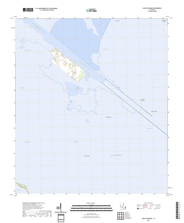
2024 Map of Lake Athanasio
USGS Topo · Published 2024About this map
The Mississippi River-Gulf Outlet Canal cuts a sharp artificial line through the fragmented marshlands of southeastern Louisiana, dominating the water-soaked geography of this coastal area. This survey documents a complex network of estuarine environments where the Gulf of Mexico meets the interior wetlands of St. Bernard Parish and Plaquemines Parish. The map reveals the precarious nature of low-lying features such as Deadman Island and Grassy Island, which are separated by broad bodies of water like Breton Sound. The transition from protected waters like Lake Athanasio and Seven Dollar Bay to the open gulf at Point Gardner highlights the region's exposure to coastal erosion and shifting tides. This environment remains a critical zone for maritime navigation, evidenced by the presence of engineered passages like Canal Pecal and Pass Fernandez amidst the natural winding of Bayou Frenepiquant.
Find a feature on this map
25 named features on this map. Tap any name to fly to it.
Don’t see what you’re looking for? This feature index may not catch every label — zoom into the map to look around manually.
Map Details
Editions of this 2024 Lake Athanasio Map
This is the sole edition of this map. No revisions or reprints were ever made.
Other maps of this area

1893 · La Fortuna
USGS Topo · 1:62,500

1893 · Shell Beach
USGS Topo · 1:62,500

1893 · Dime
USGS Topo · 1:62,500

1895 · Bodreau
USGS Topo · 1:62,500

1935 · Morgan Harbor
USGS Topo · 1:31,680

1935 · Lake Athanasio
USGS Topo · 1:31,680

1935 · Lake Calebasse
USGS Topo · 1:31,680

1939 · Shell Beach
USGS Topo · 1:62,500

1941 · Black Bay
USGS Topo · 1:62,500

1941 · Shell Beach
USGS Topo · 1:62,500