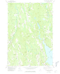
1981 Map of Lake Auburn West
USGS Topo · Published 1981About this map
Lake Auburn and the rural hills of Androscoggin County are documented here as they appeared in the early 1980s, revealing a landscape defined by small settlements and family burial grounds. The western shore of the lake is marked by The Basin and Salmon Point, while the interior terrain rises toward peaks like Hersey Hill and Woodward Mtn. The infrastructure of the era is evident in the transition from the Old Railroad Grade near Hebron Station to the small airfields like Maheu Airport and Hemond Airport in Minot.
Find a feature on this map
96 named features on this map. Tap any name to fly to it.
Don’t see what you’re looking for? This feature index may not catch every label — zoom into the map to look around manually.
Map Details
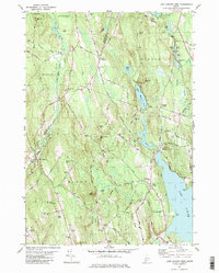
Editions of this 1981 Lake Auburn West Map
2 editions found
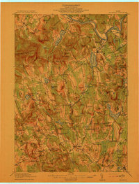
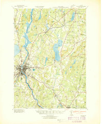
Other maps of this area

1908 · Poland
USGS Topo · 1:62,500

1908 · Lewiston
USGS Topo · 1:62,500

1910 · Livermore
USGS Topo · 1:62,500

1911 · Buckfield
USGS Topo · 1:62,500

1912 · Livermore
USGS Topo · 1:62,500
1913 · Buckfield
USGS Topo · 1:62,500

1940 · Poland
USGS Topo · 1:62,500

1941 · Livermore
USGS Topo · 1:62,500
1942 · Lewiston
USGS Topo · 1:62,500

1942 · Buckfield
USGS Topo · 1:62,500