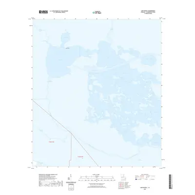
2020 Map of Lake Batola
USGS Topo · Published 2020About this map
The low-lying wetlands of Plaquemines Parish are defined by an intricate network of coastal hydrology, dominated by the expansive Grand Lake and Petit Lake. These water bodies are connected by Alligator Pass, while the larger Lake Batola sits at the heart of a fragmented marshland landscape. The River aux Chenes cuts a distinct path through the southwestern portion of the map, serving as a primary drainage corridor for the surrounding bayous.
Find a feature on this map
28 named features on this map. Tap any name to fly to it.
Don’t see what you’re looking for? This feature index may not catch every label — zoom into the map to look around manually.
Map Details
Editions of this 2020 Lake Batola Map
This is the sole edition of this map. No revisions or reprints were ever made.
Other maps of this area

1891 · Pointe a La Hache
USGS Topo · 1:62,500

1892 · St. Bernard
USGS Topo · 1:62,500

1892 · Pointe a La Hache
USGS Topo · 1:62,500

1893 · Shell Beach
USGS Topo · 1:62,500

1893 · Dime
USGS Topo · 1:62,500

1935 · Delacroix
USGS Topo · 1:31,680

1935 · Lake Batola
USGS Topo · 1:31,680

1939 · Shell Beach
USGS Topo · 1:62,500

1939 · Pointe a La Hache
USGS Topo · 1:62,500
1940 · Belle Chasse
USGS Topo · 1:31,680