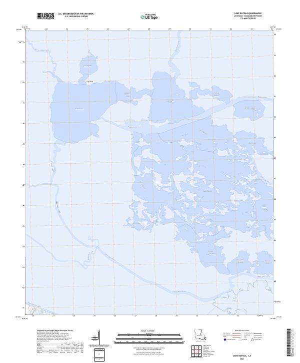
2024 Map of Lake Batola
USGS Topo · Published 2024About this map
Lake Batola and the surrounding marshlands of Plaquemines Parish characterize this 2024 landscape, defined by a complex network of coastal waterways and brackish basins. The hydrological pattern is dominated by the River aux Chenes, which threads through the southern half of the sheet, while large open water bodies like Grand Lake and Petit Lake are connected by narrow channels such as Alligator Pass and Bayou Long. This environment is a study in coastal transition, where naming conventions reflect local history and geography, from the Sun Point landmark to the sheltered waters of Pointe Fienne Bay and Bay Jack Nevette. The intricate topography of the delta is further evidenced by the smaller inlets and basins of Little Lake Batola and Shrimp Lagoon, illustrating the fragile, water-dominant character of the Louisiana coastline in the early 21st century.
Find a feature on this map
29 named features on this map. Tap any name to fly to it.
Don’t see what you’re looking for? This feature index may not catch every label — zoom into the map to look around manually.
Map Details
Editions of this 2024 Lake Batola Map
This is the sole edition of this map. No revisions or reprints were ever made.
Other maps of this area

1891 · Pointe a La Hache
USGS Topo · 1:62,500

1892 · St. Bernard
USGS Topo · 1:62,500

1892 · Pointe a La Hache
USGS Topo · 1:62,500

1893 · Shell Beach
USGS Topo · 1:62,500

1893 · Dime
USGS Topo · 1:62,500

1935 · Delacroix
USGS Topo · 1:31,680

1935 · Lake Batola
USGS Topo · 1:31,680

1939 · Shell Beach
USGS Topo · 1:62,500

1939 · Pointe a La Hache
USGS Topo · 1:62,500
1940 · Belle Chasse
USGS Topo · 1:31,680