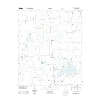
2013 Map of Lake Bonham
USGS Topo · Published 2013About this map
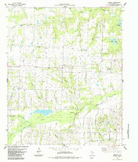
Ravenna and its grid of streets, from Sycamore to Pecan, sit on the western edge of a landscape defined by small rural hubs and an extensive network of creeks. This northern Fannin County region is characterized by small community clusters like Ivanhoe, Oakland, and White Shed, each connected by a dense web of farm-to-market and county roads. The southern portion of the area is dominated by the sprawling waters of Lake Bonham, where the Lake Bonham Recreation Area serves as a focal point for the surrounding geography. Numerous family and community burial grounds, including Odd Fellows Cem and Upper Union Cem, are scattered throughout the countryside, documenting the deep-rooted settlement patterns of the area. These features, alongside the Sandy Creek Ranch Airport and various drainage systems like Wolf Cr and Stillhouse Br, illustrate the mix of traditional agricultural land use and more modern recreational developments.
Find a feature on this map
140 named features on this map. Tap any name to fly to it.
Don’t see what you’re looking for? This feature index may not catch every label — zoom into the map to look around manually.
Map Details
Editions of this 2013 Lake Bonham Map
This is the sole edition of this map. No revisions or reprints were ever made.
Other maps of this area

1954 · Sherman
USGS Topo · 1:250,000

1957 · Wade
USGS Topo · 1:62,500

1958 · Durant
USGS Topo · 1:62,500

1958 · Bonham
USGS Topo · 1:62,500

1958 · Whitesright
USGS Topo · 1:62,500

1958 · Sherman
USGS Topo · 1:250,000
1980 · Telephone
USGS Topo · 1:24,000
1980 · Kemp
USGS Topo · 1:24,000
1980 · Yuba
USGS Topo · 1:24,000
1984 · Lamasco
USGS Topo · 1:24,000