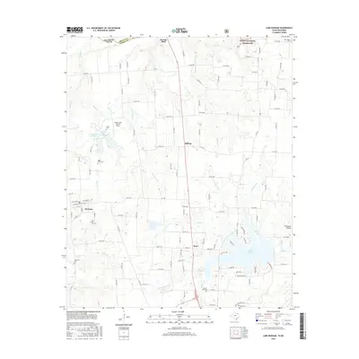
2016 Map of Lake Bonham
USGS Topo · Published 2016About this map
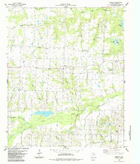
Ravenna sits at the heart of this North Texas landscape, where a grid of rural county roads connects longstanding communities and family landmarks. The area's history is preserved through numerous burial grounds, including the Odd Fellows Cem and Eminence Cem, which serve as vital markers for genealogical research. To the north, the terrain transitions toward the Red River valley, marked by Sowells Bluff and the edge of the Caddo National Grassland. The map documents a hybrid economy of traditional agriculture and modern recreation, centered on the expansive waters of Lake Bonham and smaller impoundments like Corrigan Lake Number 1. This 2016 survey captures the area's transition into the 21st century, balancing the small-town layout of Ravenna with rural developments such as the Sandy Creek Ranch Airport.
Find a feature on this map
131 named features on this map. Tap any name to fly to it.
Don’t see what you’re looking for? This feature index may not catch every label — zoom into the map to look around manually.
Map Details
Editions of this 2016 Lake Bonham Map
This is the sole edition of this map. No revisions or reprints were ever made.
Other maps of this area

1954 · Sherman
USGS Topo · 1:250,000

1957 · Wade
USGS Topo · 1:62,500

1958 · Durant
USGS Topo · 1:62,500

1958 · Bonham
USGS Topo · 1:62,500

1958 · Whitesright
USGS Topo · 1:62,500

1958 · Sherman
USGS Topo · 1:250,000
1980 · Telephone
USGS Topo · 1:24,000
1980 · Kemp
USGS Topo · 1:24,000
1980 · Yuba
USGS Topo · 1:24,000
1984 · Lamasco
USGS Topo · 1:24,000