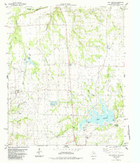
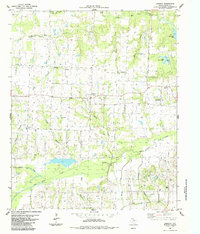
1984 Map of Lake Bonham
USGS Topo · Published 1985About this map
Lake Bonham serves as the focal point of this northern Texas landscape, where the waters of Wolf Creek and several small branches are impounded just north of the county seat. Along the northern edge of the sheet, the Red River valley is marked by Sowells Bluff and the winding course of Sandy Creek, establishing the topographical boundary between Oklahoma and Texas. The rural character of the era is preserved in small crossroads settlements like Ivanhoe, Ravenna, and Oakland, interspersed with family-named landmarks and essential community institutions. Genealogists will find significant value in the distribution of local burial sites, including the Odd Fellows Cemetery, Sandy Cemetery, and New Hope Cemetery. The presence of the Ridings Rodeo Ground and the Lake Bonham Recreation Area reflects the mid-century intersection of agricultural heritage and modern water-resource management.
Find a feature on this map
42 named features on this map. Tap any name to fly to it.
Don’t see what you’re looking for? This feature index may not catch every label — zoom into the map to look around manually.
Map Details
Editions of this 1984 Lake Bonham Map
This is the sole edition of this map. No revisions or reprints were ever made.
Other maps of this area

1954 · Sherman
USGS Topo · 1:250,000

1957 · Wade
USGS Topo · 1:62,500

1958 · Durant
USGS Topo · 1:62,500

1958 · Bonham
USGS Topo · 1:62,500

1958 · Whitesright
USGS Topo · 1:62,500

1958 · Sherman
USGS Topo · 1:250,000
1980 · Telephone
USGS Topo · 1:24,000
1980 · Kemp
USGS Topo · 1:24,000
1980 · Yuba
USGS Topo · 1:24,000
1984 · Lamasco
USGS Topo · 1:24,000