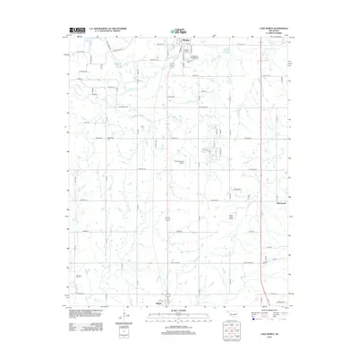
2012 Map of Lake Boren
USGS Topo · Published 2012About this map
Lake Boren and Jackson Lake anchor the northern landscape of this Okmulgee County region during the early twenty-first century. The area is defined by a dense network of creek systems, including the winding Middle Duck Cr, S Duck Cr, and Checkerboard Cr, which influenced the placement of local roads and rural homesteads. For genealogists, the map preserves the locations of several community burial grounds, such as Oakwood Cem in the north and Oakdale Cem further south.
Find a feature on this map
46 named features on this map. Tap any name to fly to it.
Don’t see what you’re looking for? This feature index may not catch every label — zoom into the map to look around manually.
Map Details
Editions of this 2012 Lake Boren Map
This is the sole edition of this map. No revisions or reprints were ever made.
Other maps of this area

1896 · Okmulgee
USGS Topo · 1:125,000

1900 · Okmulgee
USGS Topo · 1:125,000

1901 · Nuyaka
USGS Topo · 1:125,000

1914 · Kiefer
USGS Topo · 1:62,500

1916 · Kiefer
USGS Topo · 1:62,500

1946 · Fort Smith
USGS Topo · 1:250,000

1954 · Oklahoma City
USGS Topo · 1:250,000
1957 · Bixby
USGS Topo · 1:24,000

1957 · Oklahoma City
USGS Topo · 1:250,000
1958 · Sapulpa South
USGS Topo · 1:24,000