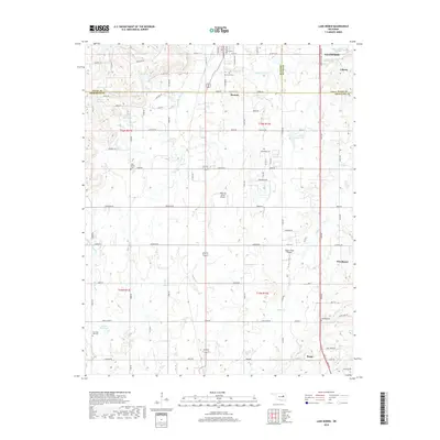
2018 Map of Lake Boren
USGS Topo · Published 2018About this map
Glenpool and the surrounding rural landscapes of Creek, Okmulgee, and Tulsa Counties are defined by a complex network of tributaries feeding into Middle Duck Creek and Eagle Creek. This 2018 survey documents a region where agricultural land and aviation strips like Ragwing Acres Airport and Eagle Creek Airport coexist with growing residential footprints. The landscape is dotted with small impoundments such as the 111012 Reservoir and the namesake Lake Boren, which serve as vital water resources for the area.
Find a feature on this map
65 named features on this map. Tap any name to fly to it.
Don’t see what you’re looking for? This feature index may not catch every label — zoom into the map to look around manually.
Map Details
Editions of this 2018 Lake Boren Map
This is the sole edition of this map. No revisions or reprints were ever made.
Other maps of this area

1896 · Okmulgee
USGS Topo · 1:125,000

1900 · Okmulgee
USGS Topo · 1:125,000

1901 · Nuyaka
USGS Topo · 1:125,000

1914 · Kiefer
USGS Topo · 1:62,500

1916 · Kiefer
USGS Topo · 1:62,500

1946 · Fort Smith
USGS Topo · 1:250,000

1954 · Oklahoma City
USGS Topo · 1:250,000
1957 · Bixby
USGS Topo · 1:24,000

1957 · Oklahoma City
USGS Topo · 1:250,000
1958 · Sapulpa South
USGS Topo · 1:24,000