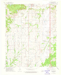
1973 Map of Lake Boren
USGS Topo · Published 1976About this map
The town of Mounds and the southwestern edge of Glenpool anchor this early 1970s landscape, which is heavily marked by the region's energy economy. The industrial footprint of the Oil Field is visible throughout, with numerous Oil Wells and a persistent Pipeline network cutting through the drainage basins of Duck Creek and Checkerboard Creek. Local infrastructure is defined by the St Louis-San Francisco railroad line, which runs north-south through the center of the survey.
Find a feature on this map
30 named features on this map. Tap any name to fly to it.
Don’t see what you’re looking for? This feature index may not catch every label — zoom into the map to look around manually.
Map Details
Editions of this 1973 Lake Boren Map
This is the sole edition of this map. No revisions or reprints were ever made.
Other maps of this area

1896 · Okmulgee
USGS Topo · 1:125,000

1900 · Okmulgee
USGS Topo · 1:125,000

1901 · Nuyaka
USGS Topo · 1:125,000

1914 · Kiefer
USGS Topo · 1:62,500

1916 · Kiefer
USGS Topo · 1:62,500

1946 · Fort Smith
USGS Topo · 1:250,000

1954 · Oklahoma City
USGS Topo · 1:250,000
1957 · Bixby
USGS Topo · 1:24,000

1957 · Oklahoma City
USGS Topo · 1:250,000
1958 · Sapulpa South
USGS Topo · 1:24,000