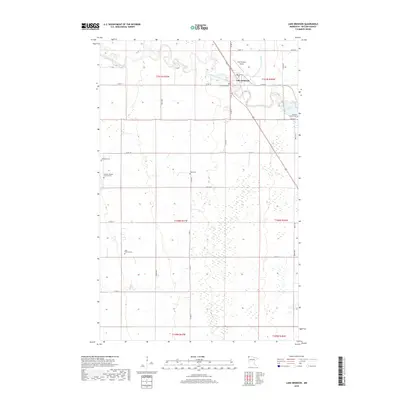
2019 Map of Lake Bronson
USGS Topo · Published 2019About this map
Lake Bronson sits at the convergence of the winding South Branch Two Rivers and the engineered channel of State Ditch Number Forty-eight in this Kittson County landscape. The town is situated along the major corridor of State St, where the local Lake Bronson Airport serves the northern prairie region. The surrounding townships are characterized by a high density of rural burial sites and family landmarks, which offer significant value for genealogical research in northwest Minnesota.
Find a feature on this map
32 named features on this map. Tap any name to fly to it.
Don’t see what you’re looking for? This feature index may not catch every label — zoom into the map to look around manually.
Map Details
Editions of this 2019 Lake Bronson Map
This is the sole edition of this map. No revisions or reprints were ever made.
Other maps of this area

1918 · Hemmington
USGS Topo · 1:62,500

1939 · Kennedy
USGS Topo · 1:62,500

1941 · Kennedy
USGS Topo · 1:62,500

1941 · Hallock
USGS Topo · 1:62,500

1952 · Thief River Falls
USGS Topo · 1:250,000

1956 · Thief River Falls
USGS Topo · 1:250,000

1956 · Karlstad
USGS Topo · 1:62,500

1957 · Thief River Falls
USGS Topo · 1:250,000

1966 · Skull Lake SE
USGS Topo · 1:24,000
1966 · Skull Lake SW
USGS Topo · 1:24,000