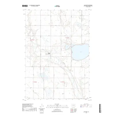
2017 Map of Lake Byron
USGS Topo · Published 2017About this map
The James River snakes through the center of this Beadle County landscape, defining the character of the terrain just north of Huron. In the heart of the river's winding valley sits the Huron Colony, a notable Hutterite settlement situated along the banks where Foster Cr joins the main branch. This 2017 survey reveals the intricate water network of the region, including the large expanse of Lake Byron and the smaller, adjacent Connors Lake and Piper Lake. The map serves as a vital resource for local history, marking the location of the Atfield Cem to the south. The land is crisscrossed by a grid of rural routes such as Co Rd 8 and Co Rd 12, which connect isolated homesteads and agricultural plots to the river corridor and the shoreline developments of N Shore Rd.
Find a feature on this map
33 named features on this map. Tap any name to fly to it.
Don’t see what you’re looking for? This feature index may not catch every label — zoom into the map to look around manually.
Map Details
Editions of this 2017 Lake Byron Map
This is the sole edition of this map. No revisions or reprints were ever made.
Other maps of this area

1895 · Byron
USGS Topo · 1:125,000

1898 · Huron
USGS Topo · 1:125,000

1953 · Huron
USGS Topo · 1:250,000

1954 · Huron
USGS Topo · 1:250,000

1956 · Lake Byron NW
USGS Topo · 1:24,000

1956 · Lake Byron
USGS Topo · 1:24,000

1956 · Spink Colony
USGS Topo · 1:24,000

1956 · Lake Byron SE
USGS Topo · 1:24,000

1956 · Hitchcock SE
USGS Topo · 1:24,000

1958 · Huron NW
USGS Topo · 1:24,000