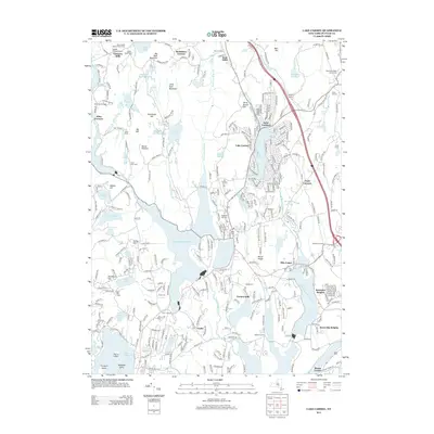
2013 Map of Lake Carmel
USGS Topo · Published 2013About this map
Lake Carmel and the surrounding highlands of Putnam County are defined by a complex network of reservoirs and smaller ponds that serve the regional water system. The 2013 landscape reveals a high density of named crossroads and residential developments, such as Kent Corners, Field Corners, and Brewster Heights, intertwined with significant water bodies like the West Branch Reservoir and Middle Branch Reservoir. Higher elevations are marked by Mount Nimham and Big Buck Mountain, while the southern reaches feature the prominent Lake Mahopac and Kirk Lake. For the local historian or genealogist, the map preserves the locations of several smaller historical sites, including the Smalley Burying Ground near the northern boundary and the Ellis Cem near the settlement of Tilly Foster. The transition from rural forest to established lakeside communities is evident in the numerous camps like Camp Brady and Camp Herrich scattered among the hills.
Find a feature on this map
76 named features on this map. Tap any name to fly to it.
Don’t see what you’re looking for? This feature index may not catch every label — zoom into the map to look around manually.
Map Details
Editions of this 2013 Lake Carmel Map
This is the sole edition of this map. No revisions or reprints were ever made.
Other maps of this area

1892 · West Point
USGS Topo · 1:62,500

1892 · Carmel
USGS Topo · 1:62,500

1893 · Carmel
USGS Topo · 1:62,500

1893 · Clove
USGS Topo · 1:62,500

1893 · Poughkeepsie
USGS Topo · 1:62,500

1894 · West Point
USGS Topo · 1:62,500

1894 · Clove
USGS Topo · 1:62,500

1894 · Carmel
USGS Topo · 1:62,500

1894 · Poughkeepsie
USGS Topo · 1:62,500

1898 · Clove
USGS Topo · 1:62,500