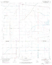
1955 Map of Lake Charles SE
USGS Topo · Published 1976About this map
Holmwood sits at the northern edge of this coastal prairie landscape, where the Southern Pacific tracks parallel a major pipeline corridor. The terrain is defined by the Petit Bois Plateau and a complex network of managed waterways including Indian Bayou, Government Ditch, and the Jacques Coulee. The map illustrates the rural character of the region during the mid-20th century, notably along the boundary between Calcasieu Parish and Cameron Parish. Local spiritual and community life is anchored by landmarks like Sweet Lake Ch and St Joseph Ch. Industrial and agricultural infrastructure is evident in the presence of the Sweet Lake Pumping Station and several levees, reflecting the engineering required to manage this low-lying environment. This 1955 survey, with purple photorevisions from 1975, provides a detailed look at the transition from natural drainage to a structured canal system including the North Canal.
Find a feature on this map
14 named features on this map. Tap any name to fly to it.
Don’t see what you’re looking for? This feature index may not catch every label — zoom into the map to look around manually.
Map Details
Editions of this 1955 Lake Charles SE Map
3 editions found
Other maps of this area

1932 · Lake Charles NE
USGS Topo · 1:31,680

1932 · Lake Charles NW
USGS Topo · 1:31,680

1932 · Lake Charles SW
USGS Topo · 1:31,680

1932 · Lake Charles SE
USGS Topo · 1:31,680

1934 · Lake Misere
USGS Topo · 1:24,000

1934 · Sweet Lake
USGS Topo · 1:24,000

1934 · Boudreaux Lake
USGS Topo · 1:24,000

1935 · Sweet Lake
USGS Topo · 1:31,680

1935 · Lake Misere
USGS Topo · 1:31,680

1935 · Boudreaux Lake
USGS Topo · 1:31,680