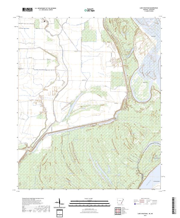
2024 Map of Lake Cheatham
USGS Topo · Published 2024About this map
Mississippi River and Arkansas River waters converge in this landscape of oxbows and bottomlands at the Arkansas-Mississippi state line. The terrain is defined by its shifting hydrology, where features like Dead Lake, Callie Lake, and Eagles Nest Lake represent former river channels now isolated in the floodplain. Large landmasses formed by these river bends include Big Island in the north and Ozark Island Number Seventyfive to the south, showcasing the complex fluvial geomorphology of the Delta.
Find a feature on this map
48 named features on this map. Tap any name to fly to it.
Don’t see what you’re looking for? This feature index may not catch every label — zoom into the map to look around manually.
Map Details
Editions of this 2024 Lake Cheatham Map
This is the sole edition of this map. No revisions or reprints were ever made.
Other maps of this area

1933 · Lamont
USGS Topo · 1:62,500

1935 · Red Fork
USGS Topo · 1:62,500

1936 · McGehee
USGS Topo · 1:62,500

1937 · McGehee
USGS Topo · 1:62,500

1939 · Big Island
USGS Topo · 1:62,500

1939 · Lamont
USGS Topo · 1:62,500

1953 · Greenwood
USGS Topo · 1:250,000

1955 · McGehee
USGS Topo · 1:62,500

1956 · Greenwood
USGS Topo · 1:250,000
1969 · Watson
USGS Topo · 1:24,000