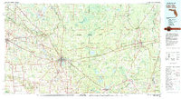
1981 Map of Lake City
USGS Topo · Published 1981About this map
Osceola National Forest dominates the central landscape of this North Florida region, characterized by extensive wetlands like the Pinhook Swamp and Mud Lake Swamp. The map documents a critical transportation corridor where the Seaboard Coast Line and Georgia Southern and Florida railroads intersect at Lake City, a major regional hub. This rail network, alongside the winding paths of the Suwannee River and Santa Fe River, illustrates the historical reliance on both water and rail for movement across the Florida-Georgia borderlands.
Find a feature on this map
90 named features on this map. Tap any name to fly to it.
Don’t see what you’re looking for? This feature index may not catch every label — zoom into the map to look around manually.
Map Details
Editions of this 1981 Lake City Map
2 editions found
Other maps of this area

1917 · Cambon
USGS Topo · 1:62,500

1917 · Macclenny
USGS Topo · 1:62,500

1917 · Hilliard
USGS Topo · 1:62,500

1918 · Middleburg
USGS Topo · 1:62,500

1918 · Moniac
USGS Topo · 1:62,500

1918 · Lawtey
USGS Topo · 1:62,500

1918 · Cambon
USGS Topo · 1:62,500

1918 · Macclenny
USGS Topo · 1:62,500

1919 · Hilliard
USGS Topo · 1:62,500

1941 · Starke
USGS Topo · 1:62,500