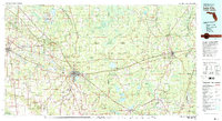
1981 Map of Lake City
USGS Topo · Published 1981About this map
Lake City and the surrounding North Florida landscape are defined here by a dense network of forest, swamp, and agricultural research during the early 1980s. The Osceola National Forest dominates the central portion of the map, anchored by Ocean Pond and the Olustee Battlefield State Historic Site. To the north and west, the iconic Suwannee River carves through the terrain near the Stephen Foster State Folk Culture Center and White Springs.
Find a feature on this map
101 named features on this map. Tap any name to fly to it.
Don’t see what you’re looking for? This feature index may not catch every label — zoom into the map to look around manually.
Map Details
Editions of this 1981 Lake City Map
2 editions found
Other maps of this area

1917 · Cambon
USGS Topo · 1:62,500

1917 · Macclenny
USGS Topo · 1:62,500

1917 · Hilliard
USGS Topo · 1:62,500

1918 · Middleburg
USGS Topo · 1:62,500

1918 · Moniac
USGS Topo · 1:62,500

1918 · Lawtey
USGS Topo · 1:62,500

1918 · Cambon
USGS Topo · 1:62,500

1918 · Macclenny
USGS Topo · 1:62,500

1919 · Hilliard
USGS Topo · 1:62,500

1941 · Starke
USGS Topo · 1:62,500