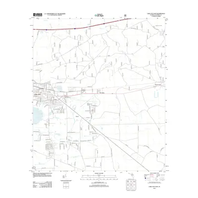
2012 Map of Lake City East
USGS Topo · Published 2012About this map
Lake City and its surrounding communities in eastern Columbia County are documented in this 2012 study, showing a landscape defined by small water bodies and significant institutional infrastructure. The map details the residential expansion of neighborhoods like Newco and Watertown, while highlighting the role of public services such as the Columbia Fire Control Headquarters and Lake City Community College. The transition from urban streets to rural reaches is marked by the presence of Lake City Municipal Airport and Rossi Field Airport, alongside the quiet heritage sites of Price Creek Cem and Truvine Cem.
Find a feature on this map
104 named features on this map. Tap any name to fly to it.
Don’t see what you’re looking for? This feature index may not catch every label — zoom into the map to look around manually.
Map Details
Editions of this 2012 Lake City East Map
This is the sole edition of this map. No revisions or reprints were ever made.
Other maps of this area

1954 · Valdosta
USGS Topo · 1:250,000

1958 · Valdosta
USGS Topo · 1:250,000

1959 · Valdosta
USGS Topo · 1:250,000

1961 · Deep Creek
USGS Topo · 1:24,000

1961 · White Springs East
USGS Topo · 1:24,000

1962 · Lake City East
USGS Topo · 1:24,000

1963 · Olustee
USGS Topo · 1:24,000

1963 · Ellisville
USGS Topo · 1:24,000

1963 · Columbia
USGS Topo · 1:24,000

1963 · Lake City West
USGS Topo · 1:24,000