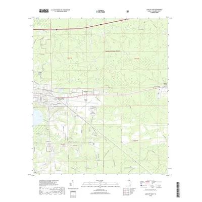
2018 Map of Lake City East
USGS Topo · Published 2018About this map
Osceola National Forest dominates the northeast quadrant of this landscape, where the flatwoods give way to the headwaters of Falling Creek. The map documents the eastern expansion of Lake City and the industrial and aviation hubs that define its perimeter, including the Lake City Gateway Airport and the campus of Florida Gateway College. To the east, the historic community of Watertown sits adjacent to Watertown Lake, reflecting the area's long-standing connection to local water resources. Smaller settlements like Wilburn and Newco are interspersed with family-named roadways and landmarks. Genealogists may find value in the location of Truvine Cem and Price Creek Cem, which sit among the drainages of Price Cr and Clay Hole Cr. The varied terrain includes the notable rise of Mount Carrie in the east, while the western edge is defined by the marshy expanse of Alligator Lake.
Find a feature on this map
117 named features on this map. Tap any name to fly to it.
Don’t see what you’re looking for? This feature index may not catch every label — zoom into the map to look around manually.
Map Details
Editions of this 2018 Lake City East Map
This is the sole edition of this map. No revisions or reprints were ever made.
Other maps of this area

1954 · Valdosta
USGS Topo · 1:250,000

1958 · Valdosta
USGS Topo · 1:250,000

1959 · Valdosta
USGS Topo · 1:250,000

1961 · Deep Creek
USGS Topo · 1:24,000

1961 · White Springs East
USGS Topo · 1:24,000

1962 · Lake City East
USGS Topo · 1:24,000

1963 · Olustee
USGS Topo · 1:24,000

1963 · Ellisville
USGS Topo · 1:24,000

1963 · Columbia
USGS Topo · 1:24,000

1963 · Lake City West
USGS Topo · 1:24,000