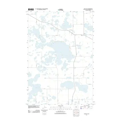
2012 Map of Lake City
USGS Topo · Published 2012About this map
Roy Lake and its surrounding glacial prairie landscape dominate this 2012 survey of northeastern South Dakota. The topography is defined by a dense network of water bodies, including Cottonwood Lake, Long Lake, and Bullhead Lake, separated by subtle elevations like Parsons Pass. The rural character of Marshall County is preserved in the grid of section roads, such as Co Hwy 12 and Roy Lake Ave, which navigate the wetlands. Local history is anchored near the shoreline of Long Lake by the Lake City Cemetery and Saint Joseph Cemetery. The map captures a landscape where water and land are intimately connected, from the large expanse of Roy Lake to smaller features like Chokecherry Island Slough and East Slough, illustrating the unique hydrology of the Coteau des Prairies region.
Find a feature on this map
36 named features on this map. Tap any name to fly to it.
Don’t see what you’re looking for? This feature index may not catch every label — zoom into the map to look around manually.
Map Details
Editions of this 2012 Lake City Map
This is the sole edition of this map. No revisions or reprints were ever made.
Other maps of this area

1953 · Milbank
USGS Topo · 1:250,000

1954 · Kidder SE
USGS Topo · 1:24,000

1958 · Milbank
USGS Topo · 1:250,000

1958 · Hillhead
USGS Topo · 1:24,000

1958 · Veblen
USGS Topo · 1:24,000

1970 · Eden
USGS Topo · 1:24,000

1970 · Britton 4 NE
USGS Topo · 1:24,000

1970 · South Red Iron Lake
USGS Topo · 1:24,000

1970 · Lake City
USGS Topo · 1:24,000

1970 · Piyas Lake
USGS Topo · 1:24,000