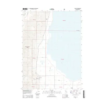
2015 Map of Lake City
USGS Topo · Published 2015About this map
Lake City sits at the base of the steep eastern slope of the Warner Mountains, where the high desert terrain of the Modoc National Forest meets the floor of the Surprise Valley. This 2015 survey illustrates the distinct geological transition between the mountain canyons and the alkaline basin, marked by geothermal activity at the Lake City Hot Springs. The settlement is defined by a grid of local roads, including S Lake St, which serve as a hub for the various creeks descending from the heights, such as Mill Cr and Daniel's Cr. The vast expanse of Upper Lake dominates the eastern half of the map, showing the seasonal hydrology characteristic of this region. Notable landmarks like Lake City Canyon and Shartell Canyon underscore the dramatic topography that has historically channeled travel and water toward the valley floor.
Find a feature on this map
34 named features on this map. Tap any name to fly to it.
Don’t see what you’re looking for? This feature index may not catch every label — zoom into the map to look around manually.
Map Details
Editions of this 2015 Lake City Map
This is the sole edition of this map. No revisions or reprints were ever made.
Other maps of this area

1886 · Alturas
USGS Topo · 1:250,000

1892 · Alturas
USGS Topo · 1:250,000

1954 · Alturas
USGS Topo · 1:250,000

1958 · Alturas
USGS Topo · 1:250,000

1962 · Alturas
USGS Topo · 1:250,000

1962 · Davis Creek
USGS Topo · 1:62,500

1962 · Willow Ranch
USGS Topo · 1:62,500

1962 · Cedarville
USGS Topo · 1:62,500

1962 · Fort Bidwell
USGS Topo · 1:62,500

1965 · Alturas
USGS Topo · 1:250,000