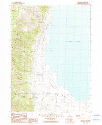
1990 Map of Lake City
USGS Topo · Published 1990About this map
The Surprise Valley floor meets the steep eastern front of the Warner Mountains in this northeastern California study. The settlement of Lake City serves as the focal point of the quadrangle, situated at the mouth of canyon drainage systems where the high-altitude forests of the Modoc National Forest descend into the desert valley. The landscape is defined by the proximity of the massive, often dry Upper Lake basin, which dominates the eastern half of the map. Numerous seasonal and perennial watercourses, including Lake City Mill South Fork, Canyon Creek, and Shartel Canyon, cut through the mountain range to provide vital water to the valley floor. Notable local landmarks include the Lake City Hot Springs and the Sanitary Disposal Site, reflecting the intersection of natural geothermal activity and modern municipal infrastructure.
Find a feature on this map
20 named features on this map. Tap any name to fly to it.
Don’t see what you’re looking for? This feature index may not catch every label — zoom into the map to look around manually.
Map Details
Editions of this 1990 Lake City Map
This is the sole edition of this map. No revisions or reprints were ever made.
Other maps of this area

1886 · Alturas
USGS Topo · 1:250,000

1892 · Alturas
USGS Topo · 1:250,000

1954 · Alturas
USGS Topo · 1:250,000

1958 · Alturas
USGS Topo · 1:250,000

1962 · Alturas
USGS Topo · 1:250,000

1962 · Davis Creek
USGS Topo · 1:62,500

1962 · Willow Ranch
USGS Topo · 1:62,500

1962 · Cedarville
USGS Topo · 1:62,500

1962 · Fort Bidwell
USGS Topo · 1:62,500

1965 · Alturas
USGS Topo · 1:250,000