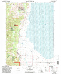
1993 Map of Lake City
USGS Topo · Published 1996About this map
Surprise Valley defines the landscape of this 1990s-era revision, where the flat, expansive basin meets the rising eastern slopes of the Warner Mountains. The settlement of Lake City serves as the focal point of the quadrangle, situated at the mouth of the Lake City Mill Fork and the South Fork Canyon Creek. The geographic character of the region is further shaped by the thermal activity at the Lake City Hot Springs and the broad shoreline of Upper Lake, which dominates the eastern portion of the sheet. Most of the high ground is managed as part of the Modoc National Forest, protecting numerous seasonal drainages like Heath Creek and Goose Creek. The network of secondary roads and trails, such as those along Powley Creek, illustrates the balance between agricultural valley life and the forested upland resource areas in Modoc County.
Find a feature on this map
22 named features on this map. Tap any name to fly to it.
Don’t see what you’re looking for? This feature index may not catch every label — zoom into the map to look around manually.
Map Details
Editions of this 1993 Lake City Map
This is the sole edition of this map. No revisions or reprints were ever made.
Other maps of this area

1886 · Alturas
USGS Topo · 1:250,000

1892 · Alturas
USGS Topo · 1:250,000

1954 · Alturas
USGS Topo · 1:250,000

1958 · Alturas
USGS Topo · 1:250,000

1962 · Alturas
USGS Topo · 1:250,000

1962 · Davis Creek
USGS Topo · 1:62,500

1962 · Willow Ranch
USGS Topo · 1:62,500

1962 · Cedarville
USGS Topo · 1:62,500

1962 · Fort Bidwell
USGS Topo · 1:62,500

1965 · Alturas
USGS Topo · 1:250,000