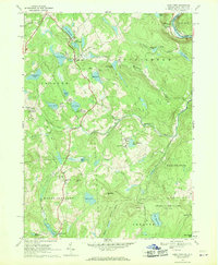
1968 Map of Lake Como
USGS Topo · Published 1970About this map
The Delaware River forms a natural border at the northeastern corner of this terrain, where the Erie Lackawanna tracks parallel the water near Dillontown. This 1968 field-checked survey reveals a landscape defined by glacial hydrology, with numerous bodies of water like Upper Twin Lake, Lower Twin Lake, and Kinneyville Pond dotting the township boundaries of Buckingham and Preston. The settlement of Lake Como serves as a local focal point, while the presence of several quarries and a Shale Pit near High Lake suggest the importance of local stone extraction during this era.
Find a feature on this map
50 named features on this map. Tap any name to fly to it.
Don’t see what you’re looking for? This feature index may not catch every label — zoom into the map to look around manually.
Map Details
Editions of this 1968 Lake Como Map
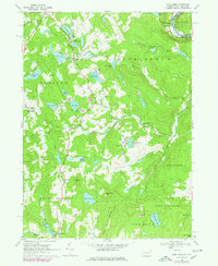
2 editions found
Other maps of this area

1892 · Honesdale
USGS Topo · 1:62,500

1920 · Long Eddy
USGS Topo · 1:62,500

1920 · Damascus
USGS Topo · 1:62,500

1921 · Long Eddy
USGS Topo · 1:48,000

1923 · Damascus
USGS Topo · 1:62,500

1923 · Long Eddy
USGS Topo · 1:62,500

1924 · Starrucca
USGS Topo · 1:48,000

1926 · Starrucca
USGS Topo · 1:62,500

1930 · Starrucca
USGS Topo · 1:48,000

1933 · Starrucca
USGS Topo · 1:62,500