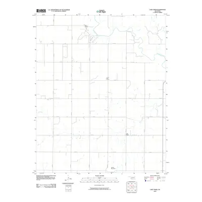
2010 Map of Lake Creek
USGS Topo · Published 2010About this map
The North Fork Red River meanders through the northern reaches of this Greer County landscape, defining a rural Oklahoma geography shaped by agriculture and energy extraction. The settlement of Lake Creek serves as a central point for the surrounding farmsteads, which are connected by an orderly grid of section line roads. In the northwest, the Moravia Oil and Gas Field indicates the industrial footprint of the region's petroleum history. To the south, the terrain shifts significantly as the Granite Mountains rise above the plains. Local history is anchored at the Pleasant Valley Cemetery, a significant site for genealogical research in this part of the state. The namesake Lake Creek drainage system threads across the southern half of the quadrangle, eventually reaching the river to the north.
Find a feature on this map
23 named features on this map. Tap any name to fly to it.
Don’t see what you’re looking for? This feature index may not catch every label — zoom into the map to look around manually.
Map Details
Editions of this 2010 Lake Creek Map
This is the sole edition of this map. No revisions or reprints were ever made.
Other maps of this area

1955 · Lawton
USGS Topo · 1:250,000

1955 · Clinton
USGS Topo · 1:250,000

1957 · Clinton
USGS Topo · 1:250,000

1961 · Willow
USGS Topo · 1:62,500

1961 · Retrop
USGS Topo · 1:62,500

1971 · Mangum North
USGS Topo · 1:24,000

1971 · Granite
USGS Topo · 1:24,000

1971 · Lake Altus
USGS Topo · 1:24,000

1985 · Elk City
USGS Topo · 1:100,000

1985 · Altus
USGS Topo · 1:100,000