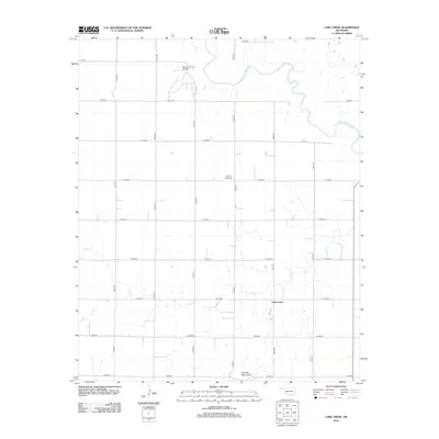
2012 Map of Lake Creek
USGS Topo · Published 2012About this map
The N Fork Red River meanders across the northeast corner of this Oklahoma landscape, defining the hydrology of a region where agricultural grid roads meet industrial extraction. The Moravia Oil and Gas Field stands as a primary point of interest for those researching the local petroleum history of Greer County. To the south, the terrain transitions toward the Granite Mountains, while the small settlement of Lake Creek serves as a central landmark for the surrounding rural community. Genealogists and local historians will find the Pleasant Valley Cem positioned centrally between north-south section lines N1990 Rd and N2000 Rd. The map detail captures the intersection of natural drainage, such as Lake Cr, with the strictly ordered township and range road network.
Find a feature on this map
22 named features on this map. Tap any name to fly to it.
Don’t see what you’re looking for? This feature index may not catch every label — zoom into the map to look around manually.
Map Details
Editions of this 2012 Lake Creek Map
This is the sole edition of this map. No revisions or reprints were ever made.
Other maps of this area

1955 · Lawton
USGS Topo · 1:250,000

1955 · Clinton
USGS Topo · 1:250,000

1957 · Clinton
USGS Topo · 1:250,000

1961 · Willow
USGS Topo · 1:62,500

1961 · Retrop
USGS Topo · 1:62,500

1971 · Mangum North
USGS Topo · 1:24,000

1971 · Granite
USGS Topo · 1:24,000

1971 · Lake Altus
USGS Topo · 1:24,000

1985 · Elk City
USGS Topo · 1:100,000

1985 · Altus
USGS Topo · 1:100,000