2016 Map of Lake Creek
USGS Topo · Published 2016About this map
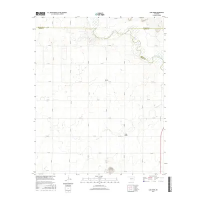
The North Fork Red River meanders across the northern portion of this landscape, marking the jagged boundaries where Greer, Beckham, and Kiowa counties meet. This rural area is defined by a rigid grid of country roads, including E1340 Rd and N1990 Rd, which connect isolated homesteads and agricultural plots. The small community of Lake Creek serves as a local anchor, situated near the headwaters of Lake Cr. To the south, the terrain rises abruptly into the Granite Mountains, providing a stark topographic contrast to the surrounding plains. Genealogists may find interest in the Pleasant Valley Cem, a key landmark for tracing family roots in this corner of Greer County. The presence of Old State Hwy 6 on the eastern edge provides a glimpse into the earlier transportation network of the region.
Find a feature on this map
26 named features on this map. Tap any name to fly to it.
Don’t see what you’re looking for? This feature index may not catch every label — zoom into the map to look around manually.
Map Details
Editions of this 2016 Lake Creek Map
This is the sole edition of this map. No revisions or reprints were ever made.
Other maps of this area

1955 · Lawton
USGS Topo · 1:250,000

1955 · Clinton
USGS Topo · 1:250,000

1957 · Clinton
USGS Topo · 1:250,000

1961 · Willow
USGS Topo · 1:62,500

1961 · Retrop
USGS Topo · 1:62,500

1971 · Mangum North
USGS Topo · 1:24,000

1971 · Granite
USGS Topo · 1:24,000

1971 · Lake Altus
USGS Topo · 1:24,000

1985 · Elk City
USGS Topo · 1:100,000

1985 · Altus
USGS Topo · 1:100,000