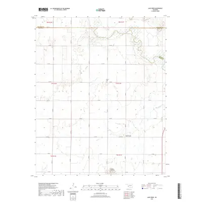
2018 Map of Lake Creek
USGS Topo · Published 2018About this map
Lake Creek anchors this western Oklahoma landscape where the prairie meets the northern edges of the Granite Mountains. The settlement sits just south of the winding North Fork Red River, which forms a complex boundary between Beckham, Greer, and Kiowa counties. The map captures a transition from the rugged outcrops of the southern hills to the expansive section-line grid that defines the local agricultural economy. For those tracing regional history, the Pleasant Valley Cem provides a specific point of interest along E1340 Rd. The drainage of Lake Cr flows through the central and eastern portions of the quadrangle, illustrating the natural watercourses that dictated early farmstead placement before the establishment of modern routes like Old State Hwy 6.
Find a feature on this map
32 named features on this map. Tap any name to fly to it.
Don’t see what you’re looking for? This feature index may not catch every label — zoom into the map to look around manually.
Map Details
Editions of this 2018 Lake Creek Map
This is the sole edition of this map. No revisions or reprints were ever made.
Other maps of this area

1955 · Lawton
USGS Topo · 1:250,000

1955 · Clinton
USGS Topo · 1:250,000

1957 · Clinton
USGS Topo · 1:250,000

1961 · Willow
USGS Topo · 1:62,500

1961 · Retrop
USGS Topo · 1:62,500

1971 · Mangum North
USGS Topo · 1:24,000

1971 · Granite
USGS Topo · 1:24,000

1971 · Lake Altus
USGS Topo · 1:24,000

1985 · Elk City
USGS Topo · 1:100,000

1985 · Altus
USGS Topo · 1:100,000