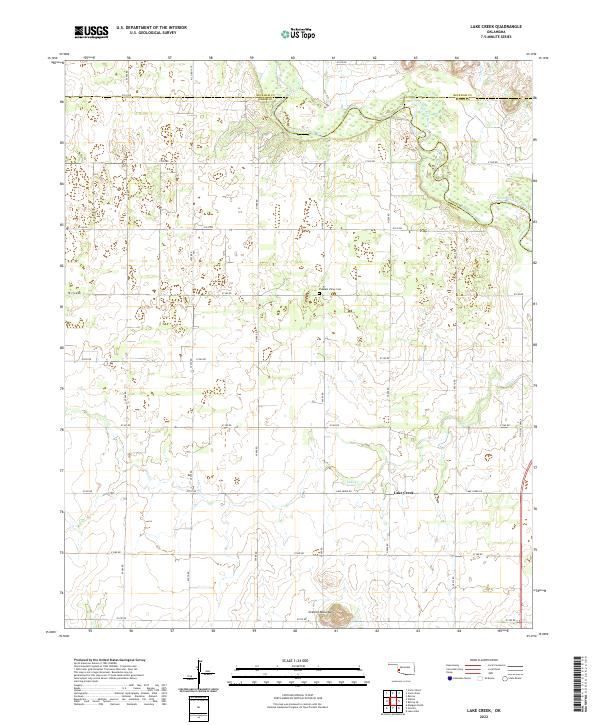
2022 Map of Lake Creek
USGS Topo · Published 2022About this map
The North Fork Red River meanders across the northern reaches of this landscape, marking the boundary where Greer, Beckham, and Kiowa counties meet. This region is characterized by a sparse rural settlement pattern centered on Lake Creek, where section-line roads like Lake Creek Rd and N2000 Rd form a rigid grid over the rolling terrain. The presence of Pleasant Valley Cem provides a focal point for genealogical research in this quiet corner of Southwestern Oklahoma. To the south, the terrain begins to shift as the northern edges of the Granite Mountains rise, contrasting with the drainages of Lake Cr. This map preserves the contemporary layout of ranching and agricultural lands, including the path of Old State Hwy 6 as it skirts the eastern edge of the quadrangle.
Find a feature on this map
32 named features on this map. Tap any name to fly to it.
Don’t see what you’re looking for? This feature index may not catch every label — zoom into the map to look around manually.
Map Details
Editions of this 2022 Lake Creek Map
This is the sole edition of this map. No revisions or reprints were ever made.
Other maps of this area

1955 · Lawton
USGS Topo · 1:250,000

1955 · Clinton
USGS Topo · 1:250,000

1957 · Clinton
USGS Topo · 1:250,000

1961 · Willow
USGS Topo · 1:62,500

1961 · Retrop
USGS Topo · 1:62,500

1971 · Mangum North
USGS Topo · 1:24,000

1971 · Granite
USGS Topo · 1:24,000

1971 · Lake Altus
USGS Topo · 1:24,000

1985 · Elk City
USGS Topo · 1:100,000

1985 · Altus
USGS Topo · 1:100,000