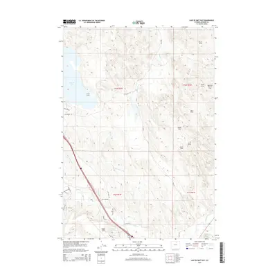
2015 Map of Lake De Smet East
USGS Topo · Published 2015About this map
Lake De Smet dominates the western edge of this High Plains landscape, where water management infrastructure defines the local geography. The eastern shoreline at Seney Point gives way to a complex network of draws and creeks, including Boxelder Cr and Murray Draw, which illustrate the natural drainage patterns of this Wyoming region. Human intervention is visible in the sophisticated irrigation and transport systems, from the Lake Desmet Canal and Redman Ditch to the Huson Reservoir near the southern boundary. In the south, the Johnson County Airport serves as a modern anchor near Rock Cr, while a network of rural routes like Belus Rd and Rock Creek Rd connect scattered homesteads and ranch lands. The map captures the intersection of industrial-scale water movement and the expansive cattle-country terrain.
Find a feature on this map
40 named features on this map. Tap any name to fly to it.
Don’t see what you’re looking for? This feature index may not catch every label — zoom into the map to look around manually.
Map Details
Editions of this 2015 Lake De Smet East Map
This is the sole edition of this map. No revisions or reprints were ever made.
Other maps of this area

1900 · Fort McKinney
USGS Topo · 1:125,000

1903 · Fort McKinney
USGS Topo · 1:125,000

1909 · Sheridan
USGS Topo · 1:125,000

1911 · Sheridan
USGS Topo · 1:125,000

1955 · Sheridan
USGS Topo · 1:250,000

1958 · Sheridan
USGS Topo · 1:250,000

1962 · Sheridan
USGS Topo · 1:250,000

1967 · Lake De Smet West
USGS Topo · 1:24,000
1967 · Banner
USGS Topo · 1:24,000
1967 · North Ridge
USGS Topo · 1:24,000