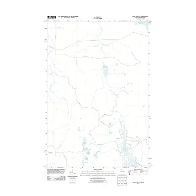
2011 Map of Lake Evelyn
USGS Topo · Published 2011About this map
The Montreal River and Black River systems define this Northwoods landscape on the border of Wisconsin and Michigan's Upper Peninsula. A complex network of glacial kettle lakes and streams dominates the southern half of the quadrangle, where Lake Evelyn, Lake Dorothy, and Lake Barbara are connected by narrow forest roads like Moser Rd. The presence of the Pine Lake Lookout Tower in the southwest suggests the importance of fire observation in this heavily timbered region. Further east, Long Lake and American Lake sit near the intersection of County Hwy G and Collins Rd, while Horseshoe Island provides a distinct landmark within the larger water bodies. The topography is characterized by drainage patterns like Wester Creek and Underwood Creek that feed into the larger river basins, illustrating the remote and water-rich environment of the Lake Superior watershed.
Find a feature on this map
36 named features on this map. Tap any name to fly to it.
Don’t see what you’re looking for? This feature index may not catch every label — zoom into the map to look around manually.
Map Details
Editions of this 2011 Lake Evelyn Map
This is the sole edition of this map. No revisions or reprints were ever made.
Other maps of this area

1939 · Winchester
USGS Topo · 1:48,000

1940 · Mercer
USGS Topo · 1:48,000

1943 · Ironwood
USGS Topo · 1:48,000

1945 · Mercer
USGS Topo · 1:48,000

1946 · Winchester
USGS Topo · 1:48,000

1947 · Mercer
USGS Topo · 1:48,000

1953 · Ashland
USGS Topo · 1:250,000

1955 · Mercer
USGS Topo · 1:62,500

1955 · Ironwood
USGS Topo · 1:24,000

1955 · Winchester
USGS Topo · 1:62,500