
1955 Map of Mercer
USGS Topo · Published 1957About this map
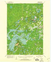
Glacial lakes and dense forests dominate the landscape of Iron County in the mid-1950s, centered on the village of Mercer. The settlement serves as a primary hub for the Chicago and Northwestern railroad, which cuts a diagonal path through the lake-rich terrain past Manitowish. To the south, the Northern Highland State Forest preserves vast tracts of woods and water, including San Domingo Lake and Grand Portage Lake.
Find a feature on this map
131 named features on this map. Tap any name to fly to it.
Don’t see what you’re looking for? This feature index may not catch every label — zoom into the map to look around manually.
Map Details
Editions of this 1955 Mercer Map
4 editions found
Other maps of this area

1938 · Lac Du Flambeau
USGS Topo · 1:48,000

1939 · Lac Du Flambeau
USGS Topo · 1:48,000

1939 · Winchester
USGS Topo · 1:48,000

1940 · Mercer
USGS Topo · 1:48,000

1940 · Butternut
USGS Topo · 1:48,000

1940 · Upson
USGS Topo · 1:48,000

1941 · Park Falls
USGS Topo · 1:48,000

1941 · Pike Lake
USGS Topo · 1:48,000

1942 · Pike Lake
USGS Topo · 1:48,000

1943 · Upson
USGS Topo · 1:48,000