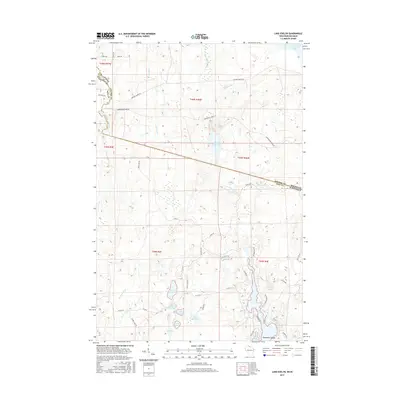
2015 Map of Lake Evelyn
USGS Topo · Published 2015About this map
The Michigan-Wisconsin border cuts through this northern lake country, where the headwaters of the Montreal River and Black River create a landscape dominated by glacial water bodies and seasonal wetlands. The map shows a transition from the industrial logging routes like Mosinee Grade Rd and Underwood Grade Rd in the north to a more recreation-focused geography in the south. Dozens of small lakes, including Lake Evelyn, Lake Barbara, and American Lake with its prominent Horseshoe Island, are connected by a network of minor roads and drainage creeks like Palms Cr and Wester Cr. The presence of numerous named "grade" roads suggests a history tied to former railroad corridors once used for timber extraction, now serving as the primary access routes into this watery interior between Gogebic County, Michigan, and Iron County, Wisconsin.
Find a feature on this map
49 named features on this map. Tap any name to fly to it.
Don’t see what you’re looking for? This feature index may not catch every label — zoom into the map to look around manually.
Map Details
Editions of this 2015 Lake Evelyn Map
This is the sole edition of this map. No revisions or reprints were ever made.
Other maps of this area

1939 · Winchester
USGS Topo · 1:48,000

1940 · Mercer
USGS Topo · 1:48,000

1943 · Ironwood
USGS Topo · 1:48,000

1945 · Mercer
USGS Topo · 1:48,000

1946 · Winchester
USGS Topo · 1:48,000

1947 · Mercer
USGS Topo · 1:48,000

1953 · Ashland
USGS Topo · 1:250,000

1955 · Mercer
USGS Topo · 1:62,500

1955 · Ironwood
USGS Topo · 1:24,000

1955 · Winchester
USGS Topo · 1:62,500