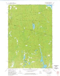
1973 Map of Lake Evelyn
USGS Topo · Published 1976About this map
The Michigan-Wisconsin border cuts through this northern landscape, dominated by a network of waterways and early logging infrastructure. Much of the central terrain is occupied by the Underwood State Wildlife Area, reflecting the region's managed timber and conservation history. The mapping reveals a transitional period where industrial use meets recreational preservation, as seen in the several Gravel Pits alongside modern boat ramps on Black River Lake and Bass Lake.
Find a feature on this map
30 named features on this map. Tap any name to fly to it.
Don’t see what you’re looking for? This feature index may not catch every label — zoom into the map to look around manually.
Map Details
Editions of this 1973 Lake Evelyn Map
This is the sole edition of this map. No revisions or reprints were ever made.
Other maps of this area

1939 · Winchester
USGS Topo · 1:48,000

1940 · Mercer
USGS Topo · 1:48,000

1943 · Ironwood
USGS Topo · 1:48,000

1945 · Mercer
USGS Topo · 1:48,000

1946 · Winchester
USGS Topo · 1:48,000

1947 · Mercer
USGS Topo · 1:48,000

1953 · Ashland
USGS Topo · 1:250,000

1955 · Mercer
USGS Topo · 1:62,500

1955 · Ironwood
USGS Topo · 1:24,000

1955 · Winchester
USGS Topo · 1:62,500