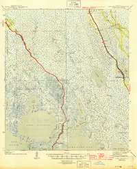
1944 Map of Lake Felicity
USGS Topo · Published 1944About this map
The linear settlement of Golden Meadow anchors the eastern edge of this 1939 coastal survey, tracing the narrow natural levee of Bayou Lafourche. This ribbon of inhabitable land stands in sharp contrast to the surrounding marshlands of Terrebonne Parish and Lafourche Parish, where human activity is limited to winding waterways like Bayou Salle and Bayou Grisgris. The map documents a community deeply tied to its geography, with several educational and religious sites such as Valere Guidry Sch, Gattino Sch, and Green Ch serving the families living along the bayou ridge.
Find a feature on this map
78 named features on this map. Tap any name to fly to it.
Don’t see what you’re looking for? This feature index may not catch every label — zoom into the map to look around manually.
Map Details
Editions of this 1944 Lake Felicity Map
This is the sole edition of this map. No revisions or reprints were ever made.
Other maps of this area

1892 · Barataria
USGS Topo · 1:62,500

1892 · Cheniere Caminada
USGS Topo · 1:62,500

1892 · Cut-Off
USGS Topo · 1:62,500

1892 · Houma
USGS Topo · 1:62,500

1892 · Creole
USGS Topo · 1:62,500

1894 · Timbalier
USGS Topo · 1:62,500

1894 · Lake Felicity
USGS Topo · 1:62,500

1894 · Dulac
USGS Topo · 1:62,500

1932 · Houma SE
USGS Topo · 1:31,680

1935 · Bourbeux
USGS Topo · 1:31,680