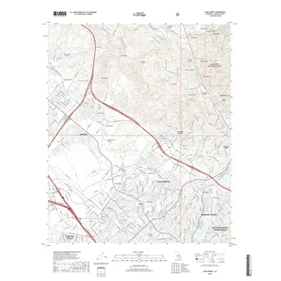
2018 Map of Lake Forest
USGS Topo · Published 2018About this map
Loma Ridge and the southwestern edges of the Cleveland National Forest dominate this landscape, where rugged canyons meet the dense residential expansion of south Orange County. The map captures a sophisticated network of transportation and water management, featuring several wash systems like Borrego Canyon Wash and Hicks Canyon Wash alongside the Siphon Reservoir. The transition from the undeveloped heights of Limestone Canyon to the master-planned communities of Irvine and Lake Forest is stark, illustrating the modern suburban character of the region. Local heritage is preserved in landmarks such as El Toro Memorial Park and the site of Tomato Spring, reflecting the area's agricultural and ranching roots before it became a hub of technology and residential development. To the east, the terrain rises sharply into named peaks and canyons including Modjeska Canyon and Harding Canyon, defining the geographic boundary of the Los Angeles Basin.
Find a feature on this map
89 named features on this map. Tap any name to fly to it.
Don’t see what you’re looking for? This feature index may not catch every label — zoom into the map to look around manually.
Map Details
Editions of this 2018 Lake Forest Map
This is the sole edition of this map. No revisions or reprints were ever made.
Other maps of this area

1896 · Santa Ana
USGS Topo · 1:62,500

1896 · Anaheim
USGS Topo · 1:62,500

1898 · Anaheim
USGS Topo · 1:62,500

1901 · Southern California Sheet No. 1
USGS Topo · 1:250,000

1901 · Santa Ana
USGS Topo · 1:62,500

1901 · Anaheim
USGS Topo · 1:62,500

1902 · Corona
USGS Topo · 1:125,000

1904 · Southern California Sheet No. 1
USGS Topo · 1:250,000

1932 · Orange
USGS Topo · 1:31,680

1932 · Tustin
USGS Topo · 1:31,680