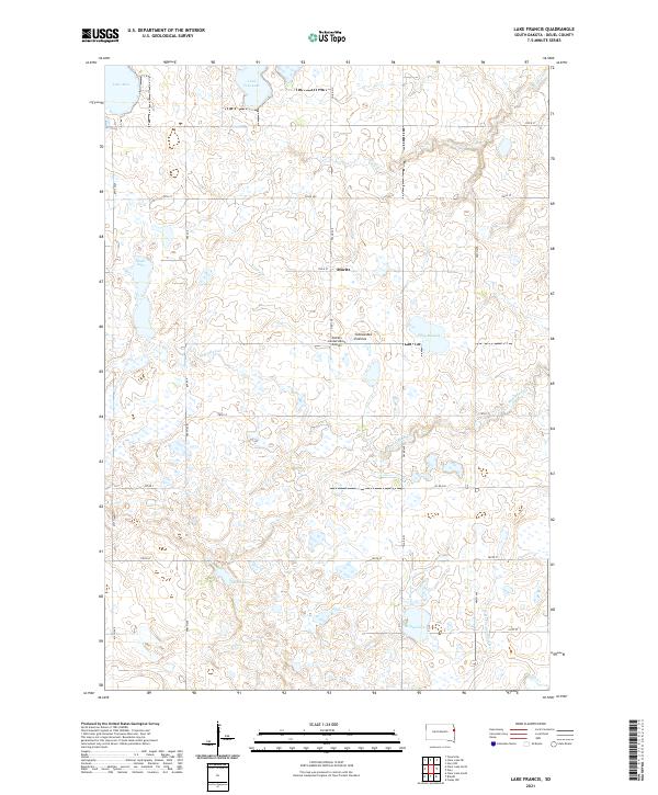
2021 Map of Lake Francis
USGS Topo · Published 2021About this map
The Coteau des Prairies plateau defines this landscape in Deuel County, creating a glacial topography of high prairie and scattered prairie potholes. The small settlement of Moritz sits at the intersection of 174th St and 482nd Ave, surrounded by numerous lakes and wetlands characteristic of this unique geological formation. The hydrology of the area is complex, with waters feeding both the W Br Lac qui Parle River and several independent basins like Lake Francis, Lake Alice, and Rush Lake. This high-altitude drainage pattern supports a sparsely populated agricultural and conservation-focused landscape, anchored by landmarks such as Stone's Conservation Airport. The township system is clearly delineated, marking the transition between t116n r48w and t116n r47w near the headwaters of Crow Cr and Monighan Cr.
Find a feature on this map
32 named features on this map. Tap any name to fly to it.
Don’t see what you’re looking for? This feature index may not catch every label — zoom into the map to look around manually.
Map Details
Editions of this 2021 Lake Francis Map
This is the sole edition of this map. No revisions or reprints were ever made.
Other maps of this area

1953 · Watertown
USGS Topo · 1:250,000

1958 · Watertown
USGS Topo · 1:250,000

1967 · Gary
USGS Topo · 1:24,000

1967 · Canby NW
USGS Topo · 1:24,000

1967 · Gary NW
USGS Topo · 1:24,000

1970 · Brandt
USGS Topo · 1:24,000

1970 · Clear Lake South
USGS Topo · 1:24,000

1973 · Tunerville
USGS Topo · 1:24,000
1973 · Lake Francis
USGS Topo · 1:24,000
1973 · Clear Lake NE
USGS Topo · 1:24,000