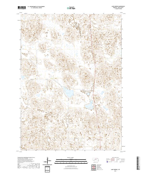
2021 Map of Lake George
USGS Topo · Published 2021About this map
Lake George and Carp Lake anchor this remote section of Rock County, where the Sandhills landscape is defined by a dense network of wetlands and ephemeral water bodies. This 2021 survey documents the sparsely populated terrain in the northern reaches of Nebraska, where section lines and local roads like Emerald Rd and 861st Rd impose a rigid grid over the undulating natural topography. The drainage patterns and seasonal basins surrounding these namesake lakes illustrate the sensitive hydrology of the region, which remains largely dominated by large-scale ranching and open grazing lands. Historically significant as part of the Great Plains cattle country, the map reveals a landscape where human footprints are limited to isolated homesteads and the maintainance of rural routes such as 445th Ave and 864th Rd.
Find a feature on this map
13 named features on this map. Tap any name to fly to it.
Don’t see what you’re looking for? This feature index may not catch every label — zoom into the map to look around manually.
Map Details
Editions of this 2021 Lake George Map
This is the sole edition of this map. No revisions or reprints were ever made.
Other maps of this area

1955 · O'Neill
USGS Topo · 1:250,000

1959 · O'Neill
USGS Topo · 1:250,000

1969 · O'Neill
USGS Topo · 1:250,000

1981 · Stonehouse Ranch NW
USGS Topo · 1:24,000

1981 · Paramount Valley
USGS Topo · 1:24,000

1981 · Rose
USGS Topo · 1:24,000
1982 · Linke Lake
USGS Topo · 1:24,000

1982 · Hagan Lake NE
USGS Topo · 1:24,000

1982 · Stockdale Lake
USGS Topo · 1:24,000
1982 · Lake George
USGS Topo · 1:24,000