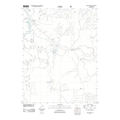
2011 Map of Lake George
USGS Topo · Published 2011About this map
Florissant and the surrounding Teller County highlands are mapped here during a period of modern ranching and recreational land use. The high-altitude landscape is defined by the South Platte River and Twin Creek, which feed into Lake George. Local industry and geology are evident in the presence of the Teller Pegmatite Mine and Blue Bird Mine, alongside the protected paleontological grounds of the Florissant Fossil Beds NM. Large private holdings like Bentleon Ranch, Signal Rock Ranch, and Blue Mountain Ranch occupy significant portions of the terrain, illustrating the continuing importance of ranching in this part of the Rockies.
Find a feature on this map
70 named features on this map. Tap any name to fly to it.
Don’t see what you’re looking for? This feature index may not catch every label — zoom into the map to look around manually.
Map Details
Editions of this 2011 Lake George Map
This is the sole edition of this map. No revisions or reprints were ever made.
Other maps of this area

1893 · Platte Canyon
USGS Topo · 1:125,000

1894 · Pikes Peak
USGS Topo · 1:125,000

1901 · Pikes Peak
USGS Topo · 1:125,000

1901 · Pikes Peak
USGS Topo · 1:62,500

1951 · Cripple Creek North
USGS Topo · 1:24,000

1953 · Denver
USGS Topo · 1:250,000

1954 · Signal Butte
USGS Topo · 1:24,000

1954 · Divide
USGS Topo · 1:24,000

1954 · Pueblo
USGS Topo · 1:250,000

1956 · Tarryall
USGS Topo · 1:24,000