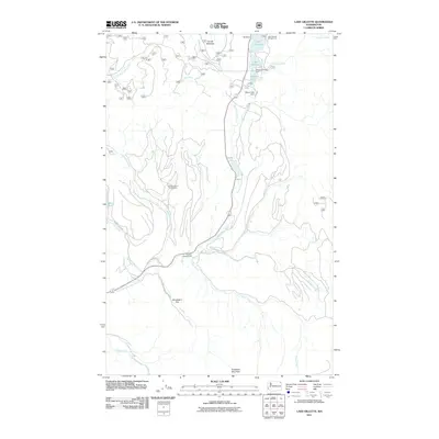
2011 Map of Lake Gillette
USGS Topo · Published 2011About this map
The Little Pend Oreille Wildlife Refuge encompasses much of this landscape in Stevens County, where the Little Pend Oreille River winds through a series of significant water bodies. A chain of lakes including Lake Thomas, Lake Gillette, and Sherry Lake forms a focal point for recreation and water management, complete with the Sherry Lake Dam. Further south, the terrain rises toward Scrabbler Mountain, overlooking the flat expanse of Scrabblers Flat and the drainage of Olson Creek. This area illustrates a mid-20th-century balance between conservation and seasonal activity, with established sites like the Spruce Canyon Youth Camp, Flodelle Campground, and the Gillette Recreation Area serving those visiting the watershed. Smaller, more isolated features like Coffin Lake and Hande Meadow provide insight into the local topography and the complex network of creeks such as Amazon Creek and Gap Creek that feed the river system.
Find a feature on this map
26 named features on this map. Tap any name to fly to it.
Don’t see what you’re looking for? This feature index may not catch every label — zoom into the map to look around manually.
Map Details
Editions of this 2011 Lake Gillette Map
This is the sole edition of this map. No revisions or reprints were ever made.
Other maps of this area

1927 · Chewelah
USGS Topo · 1:125,000

1929 · Colville
USGS Topo · 1:125,000

1930 · Chewelah
USGS Topo · 1:125,000

1933 · Colville
USGS Topo · 1:125,000

1934 · Metaline
USGS Topo · 1:125,000

1936 · Newport
USGS Topo · 1:96,000

1942 · Metaline
USGS Topo · 1:125,000

1942 · Newport
USGS Topo · 1:125,000

1952 · Aladdin
USGS Topo · 1:24,000

1958 · Sandpoint
USGS Topo · 1:250,000