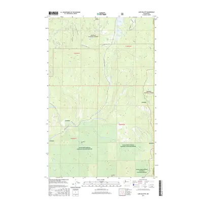
2017 Map of Lake Gillette
USGS Topo · Published 2017About this map
Lake Gillette and its neighboring waters, Lake Thomas and Sherry Lake, form a central recreational and ecological corridor in this portion of the Selkirk Mountains. The landscape is defined by the convergence of several major public lands, including the Colville National Forest, Kaniksu National Forest, and the extensive Little Pend Oreille National Wildlife Refuge. The terrain is characterized by high points like Scrabbler Mtn and Hosmer Dome, while the Little Pend Oreille River and its tributaries, such as Flodelle Cr and Gillette Cr, carve through the valleys. This 2017 survey details the complex network of forest roads and trails, including the Colville-Tiger Rd and the Little Pend Oreille ORV routes, which provide access through Hande Meadow and across the Scrabbler Flat plateau.
Find a feature on this map
34 named features on this map. Tap any name to fly to it.
Don’t see what you’re looking for? This feature index may not catch every label — zoom into the map to look around manually.
Map Details
Editions of this 2017 Lake Gillette Map
This is the sole edition of this map. No revisions or reprints were ever made.
Other maps of this area

1927 · Chewelah
USGS Topo · 1:125,000

1929 · Colville
USGS Topo · 1:125,000

1930 · Chewelah
USGS Topo · 1:125,000

1933 · Colville
USGS Topo · 1:125,000

1934 · Metaline
USGS Topo · 1:125,000

1936 · Newport
USGS Topo · 1:96,000

1942 · Metaline
USGS Topo · 1:125,000

1942 · Newport
USGS Topo · 1:125,000

1952 · Aladdin
USGS Topo · 1:24,000

1958 · Sandpoint
USGS Topo · 1:250,000