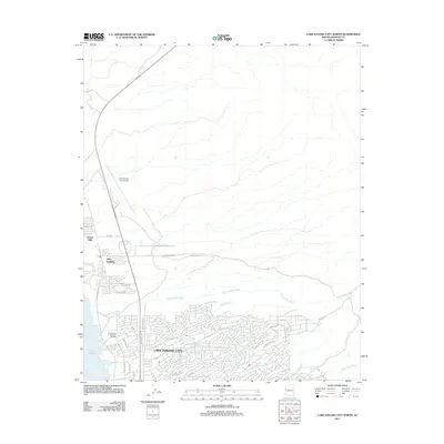
2011 Map of Lake Havasu City North
USGS Topo · Published 2011About this map
Lake Havasu City occupies the lower half of this 2011 survey, showing the intricate residential street network and drainage systems that define this desert landscape. The map details a complex grid of local roads like London Bridge Rd and College Dr alongside the arterial Route 95. A notable concentration of community features is visible near the shoreline of Lake Havasu, including Jops Landing and the Lake Havasu Memorial Gardens. To the north, the terrain transitions into more open desert, dominated by the Lake Havasu City Airport and the residential area of Desert Hills. The landscape is etched with numerous ephemeral waterways such as Falls Springs Wash, Palo Verde Wash, and Smoketree Wash, which dictate the local topography and urban layout. This map serves as a clear record of the city's expansion and its infrastructure for managing runoff in a desert environment at the start of the 2010s.
Find a feature on this map
49 named features on this map. Tap any name to fly to it.
Don’t see what you’re looking for? This feature index may not catch every label — zoom into the map to look around manually.
Map Details
Editions of this 2011 Lake Havasu City North Map
This is the sole edition of this map. No revisions or reprints were ever made.
Other maps of this area

1903 · Needles
USGS Topo · 1:125,000

1904 · Needles Special
USGS Topo · 1:125,000

1911 · Parker
USGS Topo · 1:125,000

1927 · Buck Mountains
USGS Topo · 1:62,500

1929 · Buck Mountains
USGS Topo · 1:62,500

1943 · Giers Basin
USGS Topo · 1:62,500

1943 · Topock
USGS Topo · 1:62,500

1943 · Whipple Mts.
USGS Topo · 1:62,500

1950 · Topock
USGS Topo · 1:62,500

1950 · Whipple Mts
USGS Topo · 1:62,500