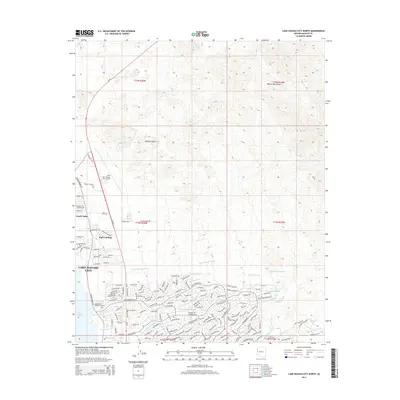
2014 Map of Lake Havasu City North
USGS Topo · Published 2014About this map
Lake Havasu City expands across the high desert shoreline of Lake Havasu, revealing a 2014 suburban landscape characterized by a dense network of residential streets and drainage systems. The northern reaches of the city are defined by the Lake Havasu City Airport and the community of Desert Hills, while the rugged Mohave Mountains rise to the northeast. This era of development is marked by a sophisticated water management system, including the Hillside Drain, Avalon Drain, and numerous natural desert washes like Falls Springs Wash and Havasupai Wash. Local landmarks such as Jops Landing and Lake Havasu Memorial Gardens provide clear points of reference for those tracking the 21st-century growth of this Mohave County hub. Transportation is anchored by Az-95 and the arterial London Bridge Rd, which facilitate the connection between the waterfront and the surrounding Mojave Desert.
Find a feature on this map
156 named features on this map. Tap any name to fly to it.
Don’t see what you’re looking for? This feature index may not catch every label — zoom into the map to look around manually.
Map Details
Editions of this 2014 Lake Havasu City North Map
This is the sole edition of this map. No revisions or reprints were ever made.
Other maps of this area

1903 · Needles
USGS Topo · 1:125,000

1904 · Needles Special
USGS Topo · 1:125,000

1911 · Parker
USGS Topo · 1:125,000

1927 · Buck Mountains
USGS Topo · 1:62,500

1929 · Buck Mountains
USGS Topo · 1:62,500

1943 · Giers Basin
USGS Topo · 1:62,500

1943 · Topock
USGS Topo · 1:62,500

1943 · Whipple Mts.
USGS Topo · 1:62,500

1950 · Topock
USGS Topo · 1:62,500

1950 · Whipple Mts
USGS Topo · 1:62,500