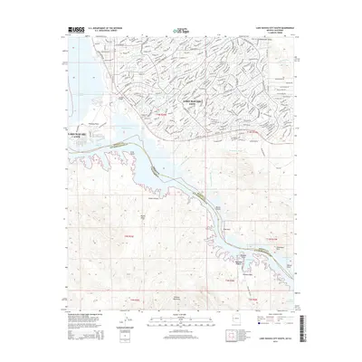
2014 Map of Lake Havasu City South
USGS Topo · Published 2014About this map
Lake Havasu City anchors the shoreline of Lake Havasu, where the modern desert city meets the Colorado River system. The 2014 landscape shows the established residential grid and iconic London Bridge, while just to the south, the terrain transitions into the protected open space of the Whipple Mountains and the Mojave Desert. The map meticulously tracks the interface between water and land, detailing numerous inlets like Copper Canyon, Thompson Bay, and Steamboat Cove. This era reflects a period of significant recreational development, evidenced by names like Havasu Palms and various designated drains and washes such as Sea Lark Drain and Pima Wash. The boundary line between Mohave County and San Bernardino County runs through the center of the lake, marking the state border between Arizona and California.
Find a feature on this map
43 named features on this map. Tap any name to fly to it.
Don’t see what you’re looking for? This feature index may not catch every label — zoom into the map to look around manually.
Map Details
Editions of this 2014 Lake Havasu City South Map
This is the sole edition of this map. No revisions or reprints were ever made.
Other maps of this area

1903 · Needles
USGS Topo · 1:125,000

1904 · Needles Special
USGS Topo · 1:125,000

1911 · Parker
USGS Topo · 1:125,000

1927 · Buck Mountains
USGS Topo · 1:62,500

1929 · Buck Mountains
USGS Topo · 1:62,500

1943 · Giers Basin
USGS Topo · 1:62,500

1943 · Topock
USGS Topo · 1:62,500

1943 · Whipple Mts.
USGS Topo · 1:62,500

1950 · Parker Dam Area
USGS Topo · 1:62,500

1950 · Topock
USGS Topo · 1:62,500