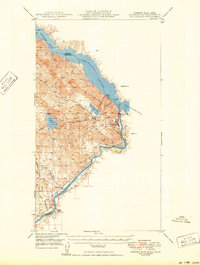
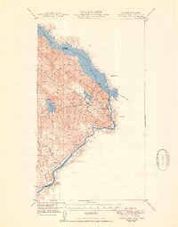
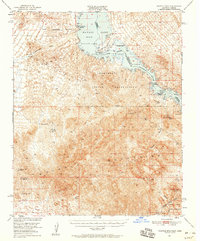
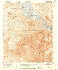
1950 Map of Parker Dam Area
USGS Topo · Published 1950About this map
The Colorado River defines this 1950 border landscape, illustrating the critical hydraulic infrastructure of the mid-century West. At the heart of the terrain is the Parker Dam, which creates the expansive Havasu Lake along the boundary of California and Arizona. The map details the complex water management systems of the era, including the Copper Basin Reservoir and several washes such as Gene Wash and Eureka Wash that feed into the river system.
Find a feature on this map
23 named features on this map. Tap any name to fly to it.
Don’t see what you’re looking for? This feature index may not catch every label — zoom into the map to look around manually.
Map Details
Editions of this 1950 Parker Dam Area Map
2 editions found
Other maps of this area

1911 · Parker
USGS Topo · 1:125,000

1943 · Giers Basin
USGS Topo · 1:62,500

1943 · Whipple Mts.
USGS Topo · 1:62,500

1943 · Parker
USGS Topo · 1:62,500
1949 · Parker
USGS Topo · 1:62,500
1950 · Parker
USGS Topo · 1:62,500
1950 · Whipple Mts
USGS Topo · 1:62,500
1952 · Whipple Mts
USGS Topo · 1:62,500

1954 · Needles
USGS Topo · 1:250,000

1956 · Needles
USGS Topo · 1:250,000