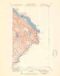
1950 Map of Parker Dam Area
USGS Topo · Published 1950About this map
Havasu Lake and the Colorado River define this mid-century landscape along the California and Arizona border, dominated by massive water reclamation and mining infrastructure. The engineering of the era is evident in the Whipple Mtn Tunnel and the placement of Parker Dam, which regulates the flow near the mouth of the Bill Williams River. While the margin notes that mining features like Black Mine and various prospects were inactive by the time of this field check, their presence across the Whipple Mountains speaks to the region's earlier industrial character. Small settlements such as Cross Roads and Cienega Springs sit near the southern riverbanks, providing a glimpse into the sparse residential footprint within the Colorado River Indian Reservation before significant modern development altered the valley floor.
Find a feature on this map
29 named features on this map. Tap any name to fly to it.
Don’t see what you’re looking for? This feature index may not catch every label — zoom into the map to look around manually.
Map Details
Editions of this 1950 Parker Dam Area Map
2 editions found
Other maps of this area

1911 · Parker
USGS Topo · 1:125,000

1943 · Giers Basin
USGS Topo · 1:62,500

1943 · Whipple Mts.
USGS Topo · 1:62,500

1943 · Parker
USGS Topo · 1:62,500

1949 · Parker
USGS Topo · 1:62,500

1950 · Parker Dam Area
USGS Topo · 1:62,500

1950 · Parker
USGS Topo · 1:62,500

1950 · Whipple Mts
USGS Topo · 1:62,500

1952 · Whipple Mts
USGS Topo · 1:62,500

1954 · Needles
USGS Topo · 1:250,000